Church of England to digitally map all 19,000 of its churchyards
The Church of England has launched an ambitious project to create a free digital map of its 19,000 burial grounds.
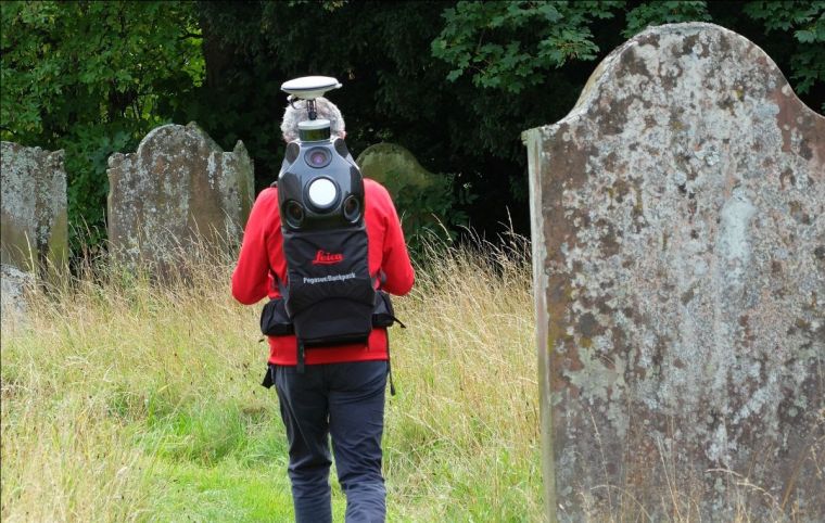
The churchyards will be scanned using sophisticated laser equipment to build up a complete picture of graves, features and biodiversity.
Scans have already been completed on the first churchyard - the pre-Norman St Bega on the shores of Lake Bassenthwaite in Cumbria.
But it is thought that the project will take at least seven years to complete.
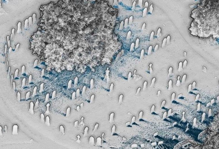
A website being launched next year will chart progress and make the map available free of charge.
The project is being largely funded by Heritage England, with additional support for the pilot phase coming from the National Lottery Heritage Fund and Caring for God's Acre.
Bishop Andrew Rumsey, the Church of England's lead bishop for church buildings, said the digital map would help with churchyard management and offer an important resource for researchers.
"This impressive national project will make a huge difference to those researching family history, as well as easing the administrative burden on parishes," he said.
"It will improve management of burial grounds, and make information more fully accessible than ever before, supported by additional services by subscription for those wishing to go further.
"It will soon be possible to visit almost any Anglican burial ground in the country and see in real time the location of burial plots. For those researching at distance in the UK or overseas, the digital records will place detailed information from churchyards at their fingertips."